Florida’s wildfire season is kicking into high gear. What started with warnings for the north and northeast parts of the state on Saturday is sliding south. By Sunday, Tampa Bay gets the spotlight, and on Monday, Southwest Florida is in the hot seat.
Blame a fierce cold front for this mess. Instead of the usual mild winter weather, Florida’s getting slammed with dry, arctic air. The temperatures will nosedive from the 80s on Saturday, down to the 60s and 70s Sunday, and then all the way into the 30s and 40s on Monday morning.
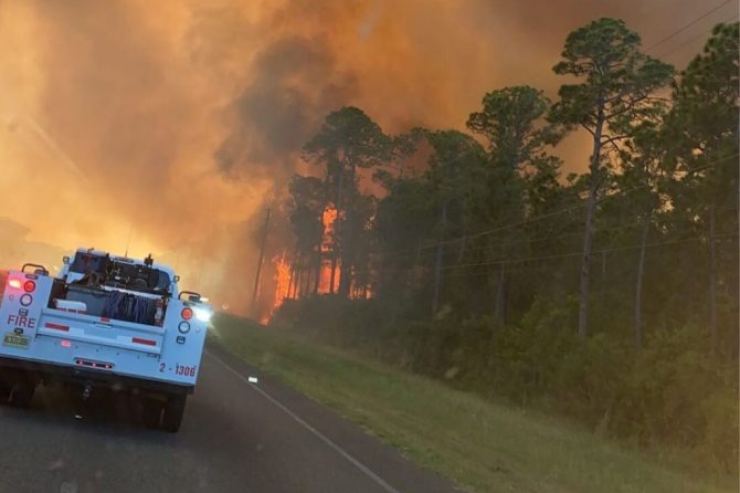
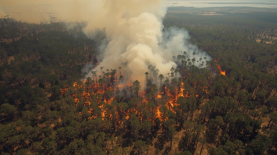
Here’s the real danger: That cold front, paired with drought, creates a perfect storm for wildfires. Winds are expected to gust up to 30 miles per hour behind the front, and humidity could drop as low as 15 percent in some spots. That’s drier than a bone. When humidity gets that low, even plants that looked healthy last week dry out fast, turning into wildfire fuel.
The National Weather Service (NWS) isn’t sugarcoating it: “Any fire that develops will catch and spread quickly. Outdoor burning is not recommended.”
Timing just makes things worse. Drought has already left a lot of dead grass and vegetation, prime tinder when you throw strong winds and desert-like humidity into the mix. The pattern of warnings follows the cold front. Saturday hits the north, Sunday targets Tampa Bay, and by Monday, Southwest Florida is on alert.
Starting early Monday, the NWS in Tampa Bay Ruskin has a Fire Weather Watch in effect through Monday evening for Lee, Charlotte, Sarasota, Manatee, Hardee, Highlands, and DeSoto counties. Winds from the northwest will push at 10 to 15 mph, with gusts up to 25. Humidity could drop to 21 percent; that’s as dry as a typical day in the Mojave Desert. Any fire that starts during these windows will race across the landscape and be tough to stop.
For Sunday afternoon, around Tampa Bay, there’s already a Fire Weather Warning because of low humidity, breezy northerly winds, and a real risk for wildfires. When you see a Red Flag Warning, that means dangerous fire weather is happening now or about to start. Strong winds, dry air, and crispy vegetation can lead to fires that move fast and get out of control.
A Fire Weather Watch means those same conditions are in the forecast, so stay tuned for updates. Red Flag Warnings can pop up quickly.
Saturday, the first alerts came from Tallahassee, and Jacksonville as that arctic blast swept southeast. Forecasters expect a Red Flag Warning on Sunday from 1 to 7 p.m. for much of North Florida, including Flagler and parts of Volusia counties.
Officials are urging everyone to hold off on outdoor burning, skip any activities that could throw sparks, and clear out dry debris around homes and buildings. This isn’t the weekend to take chances.