
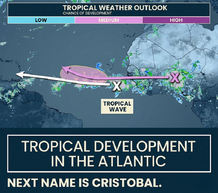
The Atlantic hurricane season’s been off to a slow start, but forecasters aren’t letting their guard down. The National Hurricane Center is tracking two areas in the Atlantic with a shot, though a small one, at developing into tropical cyclones in the coming week. Neither system threatens the U.S. right now.
We’re just hitting the season’s most active stretch, the period mid-August to mid-October, with the season’s peak usually around September 10. So far, only two storms have formed: Arthur and Bertha, both in the Gulf of Mexico. That’s the fewest named storms by this point since 2009.
About these two systems: again, the hurricane center isn’t worried about them for now, but they’re watching them. The Atlantic season runs through November 30, and history shows a quiet start doesn’t mean the second half stays tame. Colorado State University expects nine named storms this year, with four hurricanes and one major hurricane. NOAA predicts between eight and 14 named storms, including up to six hurricanes. There’s plenty of season left.
The NHC has tagged a tropical wave over Africa with a chance to develop over the next week. The next storm’s name is Cristobal.
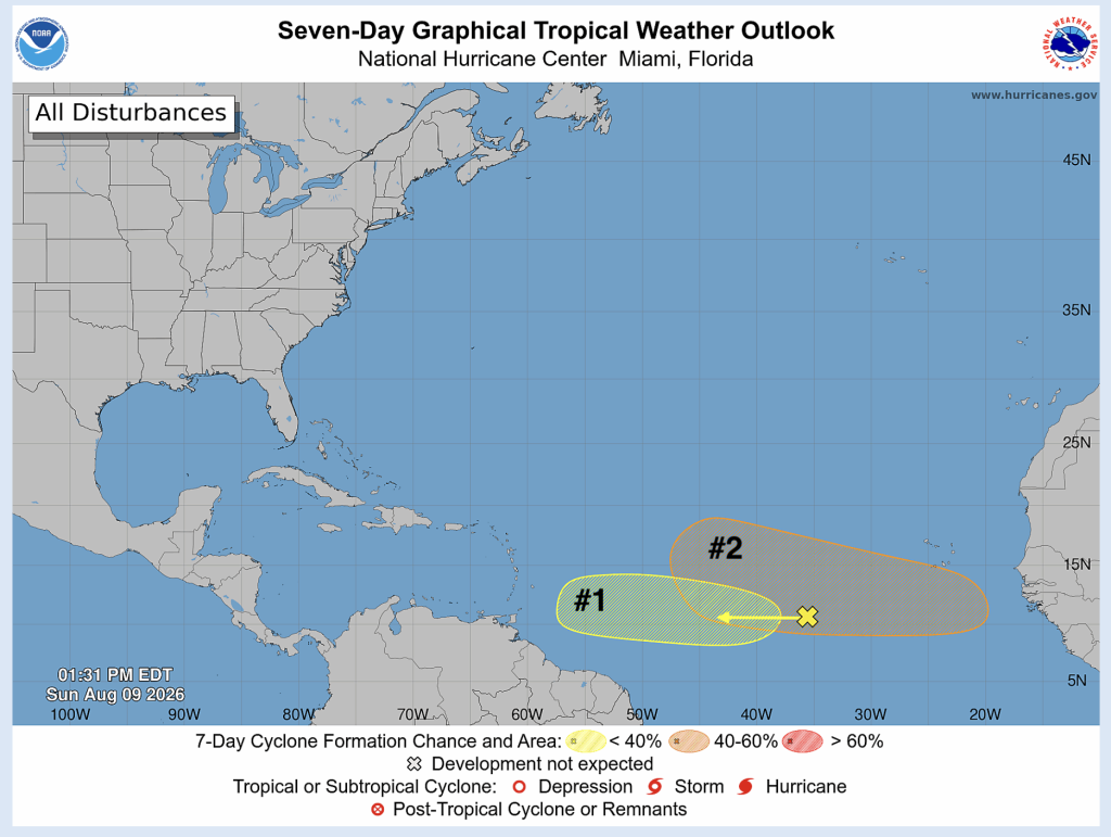
Here’s what’s going on: We have two tropical waves. One just left Africa, NHC isn’t focusing on it yet, and another, the official 20% area right now, is still over Africa. For the eastern wave, once it moves off the coast, it enters a zone with better conditions for formation. But we’re at least a week or two away from knowing if it spins up or not.
Forecast models often struggle with these early-stage waves, and until a center forms, it’s a guessing game. As for the western wave, it’ll head for the Caribbean late next week. Some models predict development, but the chances are lower than the eastern wave. Wind shear is strong right now across the Caribbean, which usually kills off anything trying to organize there.
Many of the online and television weather experts have been diving into these two new systems. They say that we hear a lot about wind shear in El Niño years, and these strong upper-level winds can tear apart growing tropical systems.
Here’s the main point from the NHC and weather analysts: The NHC is monitoring two areas. The first should hit heavy wind shear, which means it likely won’t develop. The second has a better shot since it might move north into friendlier conditions.
So that’s where things stand. The season’s been quiet, but that calm can end quickly, and forecasters are watching the Atlantic closely.