
Southwest Florida has been experiencing a stretch of dangerous heat, with some relief as we approach the weekend.
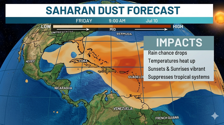
By the end of the week, drier air settles in, cutting the chances of rain. A layer of Saharan dust, fine grains blown in from Africa, arrives and hangs around through the weekend. Air quality takes a minor hit, but that dust calms the tropics, lowering the odds of any big storms developing out in the Atlantic.
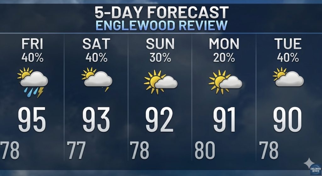
Relief finally edges in on Friday and Saturday as an upper-level low moves through. That system shifts in from the southeast, stirring up scattered showers and thunderstorms, which could cool things down in the evenings, especially near the coast.
For folks heading to the beach or out on the water, you’re in luck. Calm seas and light winds, just five knots, shifting through the day, make for excellent boating. Sunset falls right before 8:30 p.m., so evening trips should be perfect. The water is warm, sitting at 88 degrees.
On Friday, a weak disturbance will swing through, bumping up odds for scattered showers and storms to 30–40%. But another wave of Saharan dust moves in on Sunday, putting the brakes on rainfall and cranking up the heat index toward 110 degrees to start next week.
Bottom line: the heat is here, and it’s not letting up soon. Take it seriously, pace yourself, stay hydrated, and check in on those who need a little extra help.