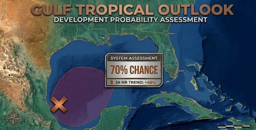
After a calm season, here’s a tropical update: Odds are climbing for a tropical system forming in the Gulf this week. As of Monday, the next name on deck is Isaias.
The National Hurricane Center just raised its likelihood to 70%, following recent model shifts. Google’s projections are even more aggressive, giving it a 90% chance to become a tropical storm. The European Model sits lower, closer to 40%.

Right now, the greatest risk for landfall stretches from Louisiana east across the Florida Panhandle and into the Big Bend. Experts do not expect Isaias to threaten Southwest Florida.
If the system hits, expect it as early as Friday, October 9, but the window runs through Monday, October 12. Most models focus on this weekend, Saturday or Sunday.

Intensity is still anyone’s guess. Some models keep it weak, a disorganized tropical depression or storm, while others go as far as calling for a hurricane. There’s very warm water and low wind shear nearby, which both favor strengthening. But as the storm lifts north or northeast, stronger wind shear and patches of dry air could knock it back or limit its growth. That’s why you’re seeing such wildly different forecasts; each model sees the environment a little differently. At this stage, keep all possibilities on the table.
Whether or not it strengthens, expect plenty of rain; flooding is a serious concern along the Northern Gulf Coast in the coming days.